Explore the Rivelin Valley
The Rivelin Valley is located to the north-west of Sheffield, linking Sheffield to the Peak District. The water catchment extends from the Hallam Moors and Redmires in the south-west to Malin Bridge in the north-east, and includes parts of the suburbs of Walkley, Crookes, Lodge Moor and Stannington.
There is a very varied landscape, including moorland, woodlands, plantations, semi-improved grasslands, agricultural land, horse paddocks, rocky crags, housing, allotments, parks, gardens, a golf course and five reservoirs. The valley is well served by public footpaths, bridleways and quiet lanes to explore.
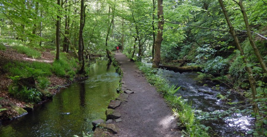
The valley-bottom has not been developed and now the Rivelin Valley nature and heritage trail follows the lower stretch of the river, between Rivelin Mill Bridge (Manchester Road) and Malin Bridge. It can be enjoyed at any time of the year. If you look carefully, you will find many types of plants, trees, birds and animals, as well as historical and archaeological remains of 20 watermills and 21 mill dams dating from the 16th to the 19th century.
How to find the Rivelin Valley
The Rivelin Valley nature and industrial heritage trail runs along the river between the two red asterisks. For more detailed maps of the trail.
Start: Rivelin Valley Road (A6101) at Malin Bridge. Nearest postcode: S6 5FE.
OS grid reference: SK 3258 8930.
End: Rails Road car park, close to the junction of Rivelin Valley Road with the A57 Manchester Road. Nearest postcode: S6 5SJ. OS grid reference SK 2912 8725.
Maps: Downloadable trail maps. Covered on Ordnance Survey map Explorer 278 Sheffield & Barnsley, Scale 1:25 000 (2½ in to 1 mile).
By public transport:
There are no direct bus routes between Malin Bridge and Rails Road, the beginning and end of the trail. However, it is possible to get to either end via public transport.
The Blue Route Supertram terminus at Malin Bridge, a 15 minute tram ride from Sheffield city centre, is close to the start of the trail.
Bus: 62/61 or 82/81 to Malin Bridge (near start of trail), or to Stannington + 15–20 minute walk
Bus: 257 to Rails Road (end of trail) via Crosspool.
Bus: 95 to Tinker Lane (Lower Walkley) + 10 minute walk
Bus: 51 to Lodge Moor (via Crosspool) + 20 minute walk
By car:
Car:
- Havelock Dam Car Park Location in OpenSteetMap
- Rivelin Park Cafe Location in OpenStreetMap – Satnav S6 5GL
- Rails Road Car Park Location in OpenStreetMap – Satnav S6 5SJ
10–20 minute drive from Sheffield city centre (depending on traffic). Cars can be parked on Rivelin Valley Road near Malin Bridge, in small car parks at Havelock Dam and Rails Road.
It is also free to park at the Malin Bridge Supertram Park and Ride site, which is close to the start of the trail at Malin Bridge, and a pleasant 20–30 minute walk along the river to the café (about 1.5 km (1 mile)).
There is limited roadside parking by the water play area / Rivelin Park café, but this can get very busy, especially at weekends and in school holidays. Please take care when parking – roadside parking is not permitted along most of Rivelin Valley Road and parking tickets are regularly issued to cars parked illegally beside the road.
Malin Bridge Supertram Park and Ride site, on Holme Lane. Postcode S6 4JR
Rivelin Water Play / Rivelin Park Café, on Rivelin Valley Road. Nearest postcode: S6 5GL

Footpaths and access
The trail is not waymarked, but it follows the river and can be started at either end. Shorter walks can also be enjoyed. Please explore, enjoy and relax in the valley, but respect the environment and archaeology so others can also enjoy it, by following the Countryside Code – keep dogs under control (and preferably out of the water to reduce disturbance to wildlife), bag and bin dog poo (even if not on or near the path), take litter home if bins are full.
Bicycles and horses are not permitted on the footpaths, but on bridleways walkers share with horses and bicycles.
Accessibility
Mostly easy walking alongside the river, especially in the first half of the trail from Malin Bridge to Glen Bridge (‘S-Bend’). There are some steps, stepping-stones and narrow paths in the south-western stretch from Glen Bridge to Rails Road. Some paths can become a little muddy and slippery after heavy rain. To complete the trail, three quite busy roads must be crossed. The trail is not suitable for most mobility scooters, except in the area around the café.
Disabled facilities are available at the toilet block next to the Rivelin Park café at Spooners Wheel.
The Rivelin Water Play area (open during the summer) is accessible to people of all abilities; special aqua wheelchairs are available for loan to disabled children and their carers. For more details see Water Park.
Facilities
There are pubs, shops and cafés at Hillsborough and Malin Bridge, three pubs close to the trail (The Anvil, near Mousehole Forge; Holly Bush near Hollins Bridge Mill and Rivelin Hotel near Hind Wheel), and a toilet block and café at Spooners Wheel. There are plenty of benches and open areas for picnics.
Further information
A book ‘Walking the Rivelin’ is available to guide you on this beautiful walk along the valley, with maps and historical details about each watermill site and where to look for the wildlife. It is richly illustrated in colour with old photographs and maps. Purchase the book.
To find out more about the individual waterpower sites visit the Rivelin Trail pages, or when on the trail use the QR Codes and NFC tags located on a series of interpretation posts found along the valley.

Maps – to view and download
Rivelin Valley Nature and Heritage Trail map – the full colour map that’s on the information boards.


