Introduction
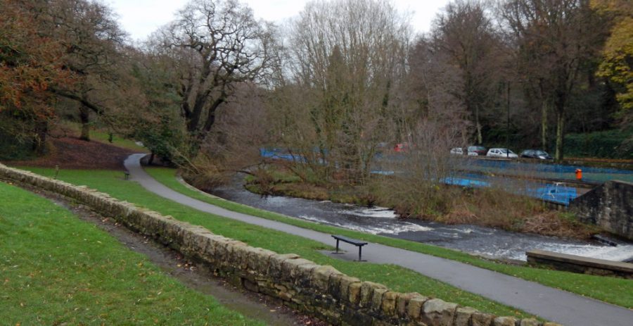
Dating from about 1724, Hollins Bridge Mill was amongst the earliest of the mills built in the Rivelin Valley. It was mainly used for grinding cutlery, fenders and optical glass, although it was converted to a corn mill in the 19th century. The mill survived into the 20th century, but had become little used by 1936. In the early 20th century, the course of the river was changed so that it flowed directly through the former mill dam and a new, wide weir was built across the river at the downstream end of the dam to maintain the depth of water needed to power the waterwheel. This weir, located just upstream of Hollins Bridge, is one of the longest in the valley.
A series of paddling pools was built on the south side of the river in the 1950s when the whole area was landscaped as part of the Festival of Britain. In 2013, the paddling pools were fully refurbished by Sheffield City Council and reopened as ‘Rivelin Valley Water Play’.
History (C 1720s–1930s)
Also known as: Chadburn Wheel, Hollins Bridge Corn Mill, Rivelin Bridge Wheel.
Main trades: Grinding cutlery, fenders and optical glass; corn mill.
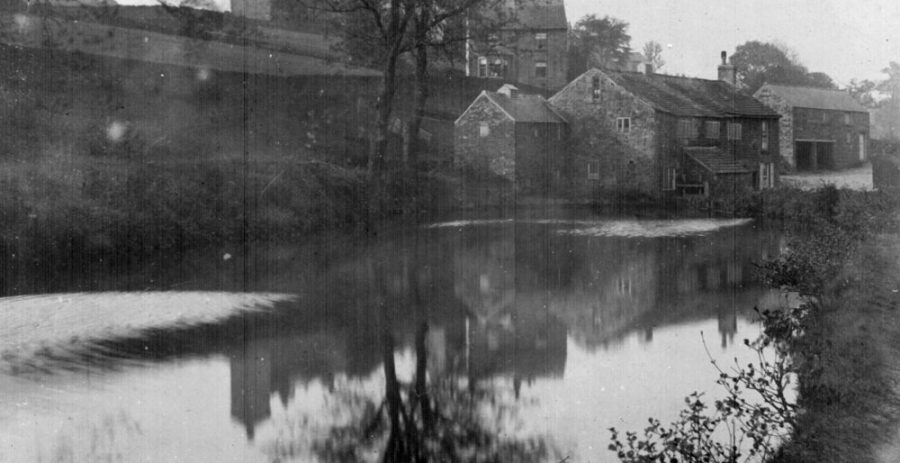
The course of the river originally ran through what is now the ‘Rivelin Valley Water Play’ area, being separated from the mill dam by a narrow embankment. A weir across the river, approximately in the location of the current bridge between Rivelin Valley Road and the café, deflected water into the head goit and thence into the mill dam.
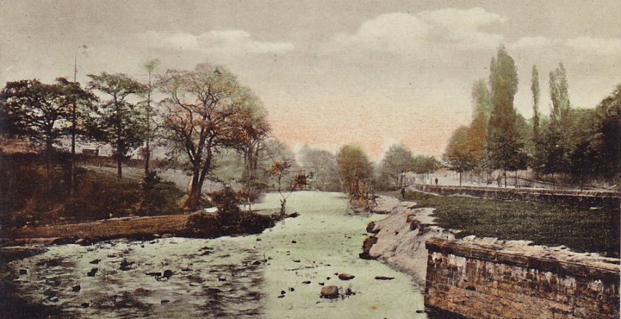
In the early 20th century, around the time the ‘New Road’ (now Rivelin Valley Road) was built along the valley bottom, the course of the river was altered so that it flowed directly through the former mill dam. Nothing remains of the original weir – the head of water needed to turn the waterwheel was preserved by a new weir (as seen in the drawing by A. Chattle – [Rivelin Artists], which is one of the longest weirs in the valley. The width of the river at this point meant that the amount of water available could be increased considerably by raising the water level even further – this was done by inserting wooden boards into metal cleats on the top of the weir.
There were further changes in this area when the paddling pools were built in 1951, since refurbished as Rivelin Valley Water Play.
What's there now?
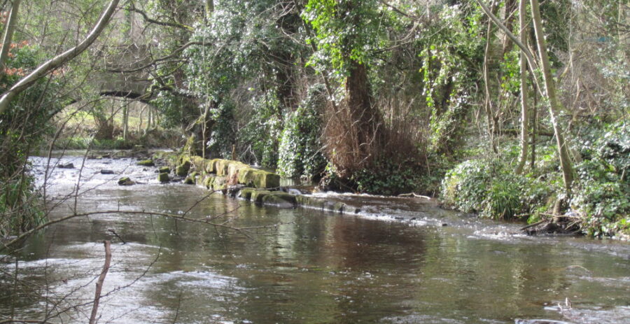
The area was landscaped in the 1950s and little now remains of this mill and its original mill dam. The weir across the river just upstream of Hollins Bridge was built in the early 1900s when the course of the river was altered, and is one of the longest in the valley. On the top of the weir can be seen the remains of four of the cleats that held wooden boards to raise the water level. The large stone structure on the north bank beside the weir is probably the remains of the intake / shuttle for the waterwheel.
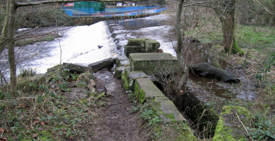
Under Hollins Bridge, the remains of the tail goit can still be seen, joining the river on the downstream side of the bridge via a channel separated from the river by a series of stone slabs. This arrangement was needed to equalise the water levels in the tail goit and river to prevent water backing up the tail goit when river levels were high (which would prevent the waterwheel from turning). A similar stone wall can be seen forming the tail goits at Holme Head Wheel and Third Coppice Wheel.
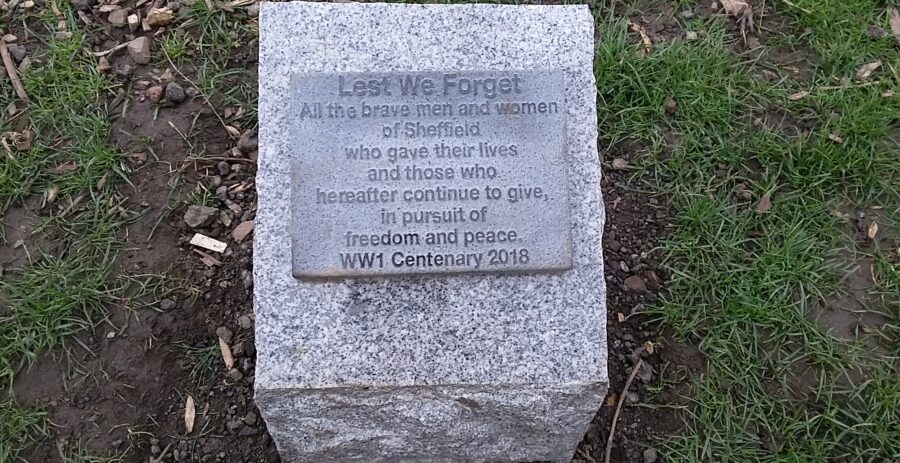
In 2019, a tree was planted in the grassed area near the café to commemorate the centenary of the ending of the First World War.
Hollins Bridge dates from the early 19th century and is Grade II listed, as is St. Michael’s Cemetery Chapel just across the road, which was built in 1877–78. Further details of these, and other listed buildings in the valley, can be found on the Historic England website
Rivelin Valley Water Play
The original Rivelin Valley Park, including the children’s playground on the site of the former Spooners mill dam and the paddling pools alongside the road, was created during the 1950s as part of the Festival of Britain. The paddling pools used water flowing in from the River Rivelin. When the river level is low, the water inlets for the original paddling pools can be seen at the bottom of the wall just above the weir. The large ‘ruler’ (gauge board) fixed to the wall here is used by the Environment Agency to monitor water levels in the river
In 2013, the old paddling pools were fully refurbished by Sheffield City Council, and reopened as ‘Rivelin Valley Water Play’. The changes include a new toilet block, a new water filter system, improved access to the three large splash pads with anti-slip surfacing, a variety of water-play equipment, such as jets, sprinklers, bucket drops and water tables, and ramped access with handrails into the paddling pool. The improved facilities were partly funded by the ‘Aiming High for Disabled Children’ programme.
Details of facilities and opening times are available from Sheffield City Council website – parks-sport-recreation
Nature and wildlife at Hollins Bridge Mill
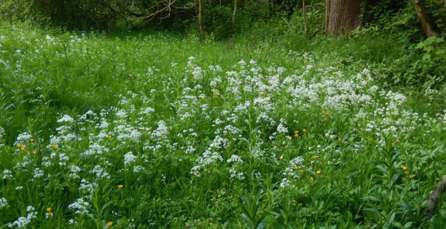
On the north side of the river, the broad band of wetland vegetation between the path and river marks the former extent of the mill dam. In spring, look out for the white flower spikes of Bittercress here.
On the north bank of the river there are several old Ash and Oak trees near the path. Also look out for large clumps of Pendulous sedge, especially under the trees on the bank between the river and Rivelin Valley Water Play area. The tall, nodding, catkin-like flower spikes appear from about May to July.
Near the weir below the café, are a Weeping Willow, two Rowan trees and tall pines, and in summer at the river’s edge, the yellow flowers of the Monkey-flower.
Mallard ducks can usually be seen along this stretch of river or at the weirs, and Grey wagtails sometimes feed in the shallows. A Grey heron is occasionally seen sitting on top of the long weir. The open grassy areas attract ground feeders such as Blackbird, and the margins of the surrounding undergrowth provide good habitat for butterflies. Also look and listen out for Thrush, Robin, Wren and various types of tit.
A shrew and possibly a water vole were seen on the river bank in 2015. If correct, this is the first record of water vole in the valley for many years – please contact RVCG with any further sightings.
Just below Hollins Bridge there is a multi-trunked Bird Cherry tree – this has white flowers in spring and dark purple/black cherry-like fruits in autumn.
Art at Hollins Bridge Mill

The stone bench alongside the path near the river was commissioned and installed by the RVCG in 2021 to celebrate the 30th Anniversary of the Group. It was designed by Sheffield stonemason ‘Stoneface’ and carved from Scottish sandstone. The carvings depict the wildlife and industrial heritage of the valley. Photographs of the bench and an account of the unveiling ceremony can be seen at on our Heritage Open Day webpage.
Location
The Hollins Bridge Mill site is located on the north side of the river, between the Holly Bush Inn on Hollins Lane and the Rivelin Park café. The site is owned by Sheffield City Council and there is open access. A public footpath passes the site and can be easily accessed from Hollins Lane and Rivelin Valley Road.
A marker post installed at the site by Rivelin Valley Conservation Group gives a brief history and links to this website.
OS map grid reference: SK 3219 8849
Nearest postcode: S6 5GL
