Introduction
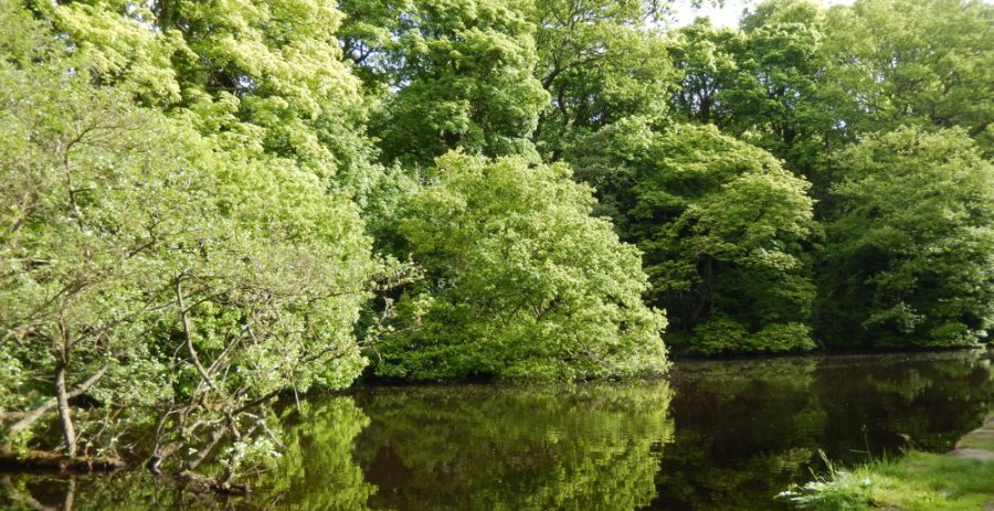
The Wolf Wheel mill dam is the largest in the valley still with open water and is maintained for recreational use. Overhanging oak trees on the far bank provide wonderful autumn colours.
Wolf Wheel dates from the early 1720s, and had what was probably the largest grinding room in the valley, used for grinding cutlery and razors. It was last recorded being used in 1930. The wheel pit is partly infilled and overgrown but some remains of the buildings can still be seen.
The footbridge across the river just downstream from Wolf Wheel marks an old cross-valley route from Dore to Bradfield. To the north the footpath climbs up a steep cobbled path to Rivelin Valley Road and to the south up the valleyside through fields to Manchester Road (A57).

History (C. 1720s–1930s)

Also known as: Rocher Wheel, Rocker Wheel.
Main trades: Cutlery and razor grinding.
Wolf Wheel was built in the early 1720s. In 1794, there were 11 trows with 16 men employed. By 1830 an iron overshot waterwheel (15 ft x 6 ft 8 in; c. 4.6 x 2 m) ran 17 table-knife trows and two razor trows, making it probably the largest grinding room in the valley.

James & Samuel Windle rented the mill from 1810–1852. In 1838 the Windles were in such disagreement over their business affairs that arbitrators were called in. Samuel subsequently sold his half of the mill to Joseph, who in 1852 sold the Wheel to the Sheffield Waterworks Company.
Wolf Wheel was last recorded as being used in 1930, but the pentrough and shuttles were reported in good working order in 1934 and there is a report that the company Rabone Chesterman moved some of their tool making work there during the war.
The mill dam was dredged and the stone bridge that crosses the overflow was built in 1967. In 2005 Sheffield City Council reinforced the dam wall alongside the river, to help prevent erosion and potential collapse. Further work was undertaken in 2016–17 to reinforce the dam wall near the wheel pit.
What's there now?
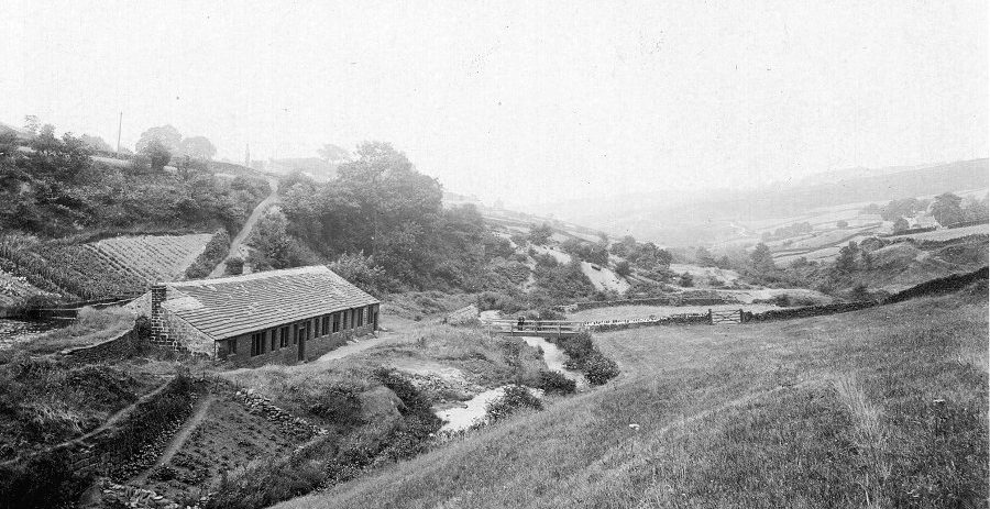
The mill dam is the largest in the valley maintained for recreational use (fishing). The trail runs along the wall of the mill dam quite high above the river, crossing the overflow by an unusual narrow stone bridge – this was built in 1967, when the original Nature Trail was constructed (the forerunner can be seen in a photograph above in the History section).
The four-bay weir is in good condition. The shuttle on the head goit entry has been replaced by a modern gate. The tail goit from Frank Wheel (next upstream) runs into the Wolf head goit just below the weir.
The wheel pit is partly infilled and overgrown but some remains of the buildings can still be seen. The long tail-goit runs into the river just above the Swallow weir.
Nature
The Wolf Wheel mill dam is the largest in the valley still with open water. Overhanging oaks on the far bank provide wonderful autumn colours, with goat willow and alder also at the water’s edge.
This is another great place to see nesting Mallard and Moorhens. A Kingfisher can sometimes be seen perching on the dead fallen tree that lies across the mill dam. Also look out for dragonflies, Great Diving Beetles, frogs and newts.
By the 1960s the mill dam was becoming overgrown, but in 1967 it was dredged to restore open water and stocked with Bream, Tench and Crucian Carp; it is still used for fishing.
Art
Location
The site of the Wolf Wheel can be found to the south of Rivelin Valley Road near to its junction with the western end of Tofts Lane. The site is owned by Sheffield City Council and there is open access. A public footpath along the valley passes the site. The footbridge across the river just downstream from Wolf Wheel marks an old cross-valley route from Dore to Bradfield. To the north the footpath climbs up a steep cobbled path to Rivelin Valley Road and to the south up the valleyside through fields to Manchester Road (A57).
A marker post installed at the site by Rivelin Valley Conservation Group gives a brief history and links to this website.
OS map grid reference: SK 3018 8750
Nearest postcode: S6 5SG
